


Brownsville Voting District, Kitsap County, Washington
About
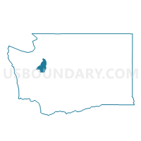
Outline

Summary
| Unique Area Identifier | 687318 |
| Name | Brownsville Voting District |
| County | Kitsap County |
| State | Washington |
| Area (square miles) | 3.43 |
| Land Area (square miles) | 2.76 |
| Water Area (square miles) | 0.67 |
| % of Land Area | 80.50 |
| % of Water Area | 19.50 |
| Latitude of the Internal Point | 47.66056970 |
| Longtitude of the Internal Point | -122.62996130 |
Maps


Graphs
Select a template below for downloading or customizing gragh for Brownsville Voting District, Kitsap County, Washington


Neighbors
Neighoring Voting District (by Name) Neighboring Voting District on the Map
- Bucklin Voting District, Kitsap County, WA
- Gilberton Voting District, Kitsap County, WA
- Island Lake Voting District, Kitsap County, WA
- Keyport Voting District, Kitsap County, WA
- Meadowdale Voting District, Kitsap County, WA
- Ridgepoint Voting District, Kitsap County, WA
- Ridgetop Voting District, Kitsap County, WA
- Tolo Voting District, Kitsap County, WA
Top 10 Neighboring County Subdivision (by Population) Neighboring County Subdivision on the Map
- Bremerton CCD, Kitsap County, WA (105,827)
- Poulsbo CCD, Kitsap County, WA (43,309)
- Bainbridge Island CCD, Kitsap County, WA (23,025)
Top 10 Neighboring Place (by Population) Neighboring Place on the Map
Top 10 Neighboring Unified School District (by Population) Neighboring Unified School District on the Map
- Central Kitsap School District, WA (68,814)
- North Kitsap School District, WA (45,966)
- Bainbridge Island School District, WA (23,025)
Top 10 Neighboring State Legislative District Lower Chamber (by Population) Neighboring State Legislative District Lower Chamber on the Map
Top 10 Neighboring State Legislative District Upper Chamber (by Population) Neighboring State Legislative District Upper Chamber on the Map
Top 10 Neighboring 111th Congressional District (by Population) Neighboring 111th Congressional District on the Map
Top 10 Neighboring Census Tract (by Population) Neighboring Census Tract on the Map
- Census Tract 917, Kitsap County, WA (7,944)
- Census Tract 912.03, Kitsap County, WA (7,182)
- Census Tract 916, Kitsap County, WA (6,356)
- Census Tract 911, Kitsap County, WA (4,866)
- Census Tract 908, Kitsap County, WA (4,169)
- Census Tract 915, Kitsap County, WA (3,968)